
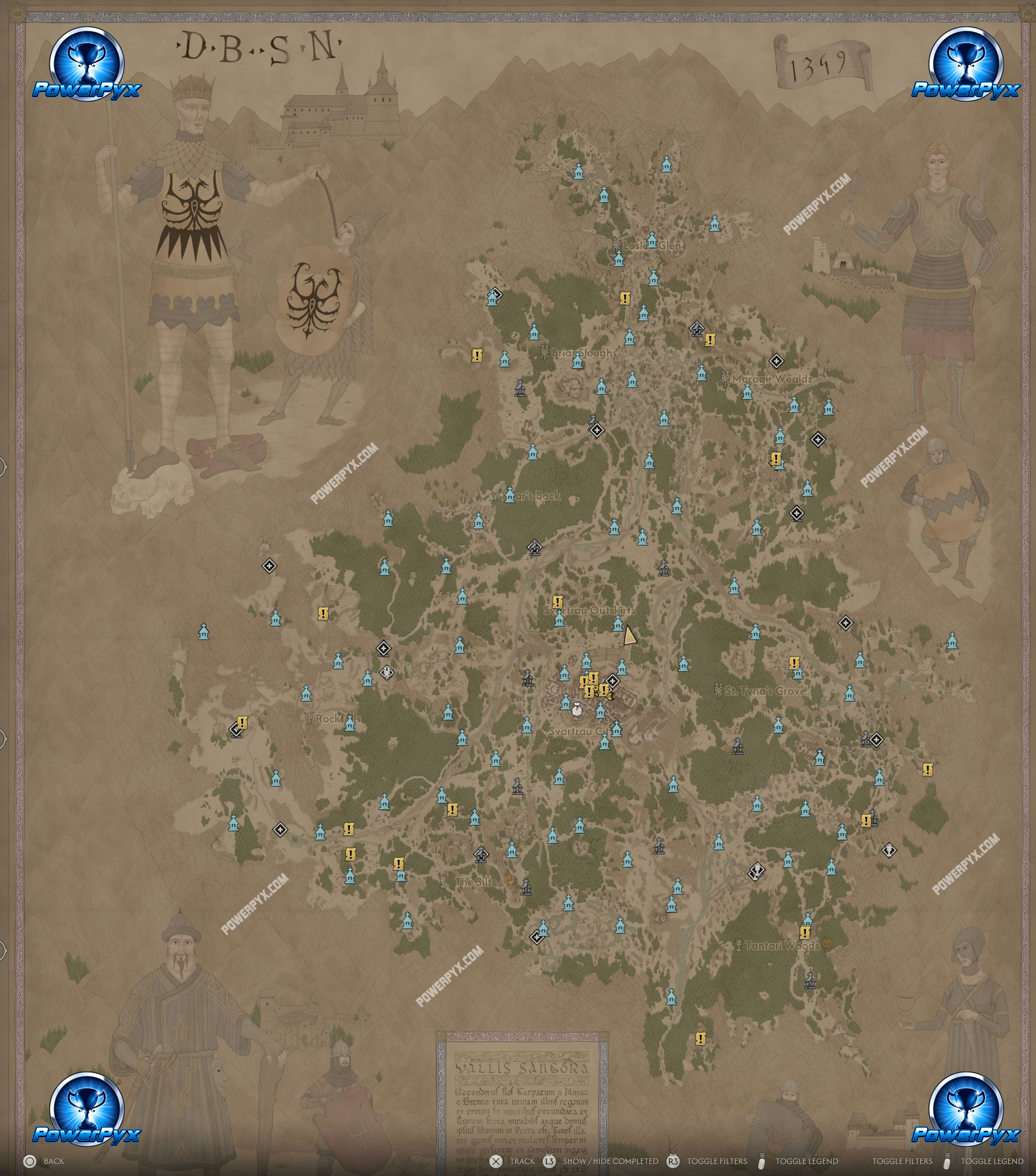
The Blood of Dawnwalker has an open world map that measures around 10km². This page reveals the full in-game map in high resolution.
The game is set in the land of Laslea, divided into 10 regions: Laslea Glen, Briar Sloughs, Maragir Wealds, Boar’s Back, Svartrau Outskirts, Svartrau City, Rockfalls, St. Tyna’s Grove, The Slits, Tantari Woods.
The total map size of The Blood of Dawnwalker is 10km² (around 4km height x 3km width at the widest points, but narrower in the upper half). It’s entirely land mass and only explorable on foot, there are no mounts to ride around with. However, you can buy the Vampirism skill “Shapeshift” and Witchcraft skill “Mercurial Fervour” to run much faster. There are also  Shrines for fast travel.
You can mark all locations by climbing the  Towers, then all collectibles and quests get marked by white “?” icons on the map. Going near those icons then reveals what type of activity it is. It takes around 3-4 hours to fully unfog all map icons and visit all Shrines.
Below you can find the full Blood of Dawnwalker World Maps (In-Game Map) with all Shrines revealed:
The Blood of Dawnwalker Map (Laslea)
For more guides and all collectibles, check our The Blood of Dawnwalker 100% Completion Guide.
Leave a Reply